On March 8, 2014, Malaysia Airlines Flight 370, also known as MH370, disappeared from radar screens with 239 people on board. The Boeing 777-200ER was en route from Kuala Lumpur to Beijing, but somewhere over the South China Sea, it veered off course and vanished without a trace. What followed was the most expensive and mystifying search operation in aviation history. Years later, the disappearance remains unsolved—and the public’s fascination with it has only grown.
In recent years, online sleuths and digital mapping enthusiasts have turned to tools like Google Maps and Google Earth, hoping to uncover what global aviation and naval teams could not. The term “Malaysia Airlines Flight 370 Google Maps” has surged in search queries, reflecting renewed public interest in whether satellite imagery and digital forensics could finally provide answers.
The Rise of Digital Detectives
As official searches dwindled due to cost and lack of conclusive leads, internet users took matters into their own hands. Reddit forums, YouTube videos, and dedicated blogs sprouted, many relying on tools like Google Maps, Google Earth, and commercial satellite platforms. The idea was simple: comb through thousands of satellite images, particularly of the Southern Indian Ocean and remote landmasses, in search of something—anything—that could resemble airplane debris.
One of the reasons this digital sleuthing gained traction is due to how accessible Google Maps is. Anyone with an internet connection can explore high-resolution satellite imagery, measure distances, and even view changes over time through Google Earth’s “historical imagery” function. For many, this democratized access offered a glimmer of hope in solving a case that had stalled for years.
Google Maps: Clues or Coincidence?
The phrase “Malaysia Airlines Flight 370 Google Maps” has become synonymous with amateur investigations. In several instances, people claimed to have spotted airplane-like shapes in satellite images. One such viral claim surfaced in 2018 when an Australian engineer, Peter McMahon, claimed he found MH370’s wreckage off the coast of Mauritius using Google Earth. His assertions were dismissed by officials and aviation experts, but the post went viral, fueling widespread speculation.
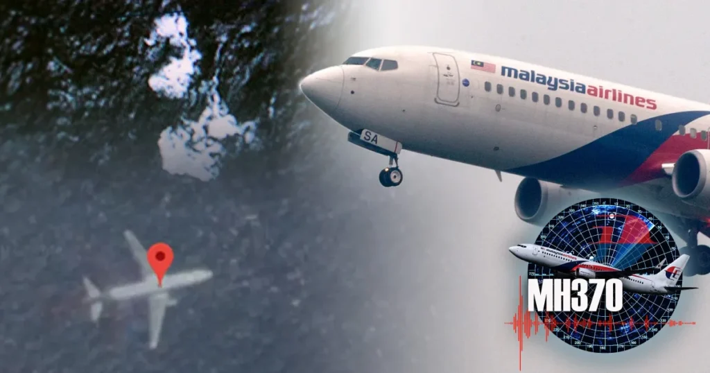
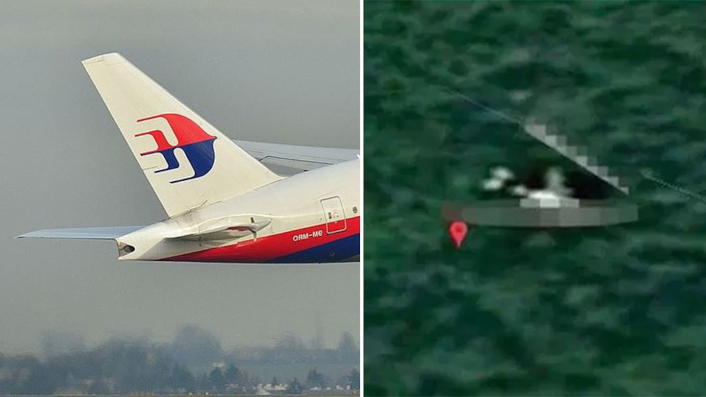
Other users pointed to an airplane-shaped object spotted in a Cambodian jungle, leading to widespread YouTube coverage and another burst of interest in the topic. While Google Maps provides impressive satellite imagery, it is not in real-time. The images may be months or even years old, and interpreting them can be highly subjective. Many of the “discoveries” turned out to be other aircraft, natural formations, or image glitches.
Still, the question persists: Can Google Maps help solve the MH370 mystery?
Satellite Imaging vs. Traditional Search Operations
The search for MH370 involved advanced underwater sonar, aerial surveys, and satellite data analysis conducted by national agencies including Australia’s ATSB, Malaysia’s Department of Civil Aviation, and international partners. Despite this, most of the aircraft has never been found. Only a few pieces of debris, confirmed or suspected to be from MH370, have washed up on beaches in the western Indian Ocean, including Réunion Island and Madagascar.
Unlike real-time satellite imaging used by search agencies, Google Maps and Google Earth compile satellite photos for civilian use, often updated only annually or quarterly. This delay limits their effectiveness in time-sensitive searches. Furthermore, these tools aren’t designed to detect small, fragmented objects like airplane debris in turbulent ocean waters.
Yet, the public’s effort to use “Malaysia Airlines Flight 370 Google Maps” isn’t entirely fruitless. The process of crowdsourced searching has pushed conversations forward, inspired documentaries, and applied pressure on authorities to continue the investigation. It has also raised questions about transparency in satellite data and whether more could be shared with the public.
The Role of Ocean Currents and Drift Modeling
One scientific method that gained attention in the MH370 case is drift modeling—using ocean current patterns to estimate the possible crash site based on where debris was found. Experts from organizations like CSIRO (Australia’s national science agency) used complex simulations to narrow down potential locations. While these are based on real-world data, they don’t offer exact coordinates.
Here is where enthusiasts hoped Google Maps could supplement these findings. By aligning drift model paths with visible locations on satellite imagery, some believed they could manually pinpoint likely crash zones. While there’s no confirmed success from these efforts, the collaborative nature of crowdsourced geography remains a powerful example of public engagement in global mysteries.
The Influence of MH370 on Digital Mapping Culture
The MH370 disappearance arguably popularized the use of tools like Google Earth for unsolved mysteries. In a world where millions have smartphones and internet access, digital cartography is no longer limited to experts. The incident helped forge a new type of community—one that blends aviation curiosity, conspiracy theories, and citizen science.
Many forums now have dedicated threads to search theories, updated coordinates, and possible sighting screenshots. Some go as far as using 3D modeling to simulate what MH370 might look like underwater or on land, depending on various crash scenarios. The common thread is a persistent belief that Google Maps might still hold clues hidden in plain sight.
Malaysia Airlines Flight 370 Google Maps: A Heading of Hope or a Dead End?
When you search for Malaysia Airlines Flight 370 Google Maps, you’ll find an amalgamation of amateur investigations, media coverage, and digital rabbit holes. While nothing found via Google Maps has been officially confirmed as part of MH370, the public’s passion hasn’t waned.
This highlights something bigger than satellite imagery—it shows a deep human need for closure. The families of the 239 victims, many of whom still have no confirmed explanation of their loved ones’ fate, are at the heart of this global mystery. Any new theory, any possible sighting—especially one backed by visual maps—gives a sliver of hope that the story might one day come to a close.
Lessons Learned from the MH370 Tragedy
The enduring mystery of MH370 has changed how the aviation world deals with emergencies and tracking. Following the incident, there has been a push toward better real-time aircraft tracking over oceans, improvements in transponder technology, and updated protocols in aviation crisis response.
From a technological standpoint, it also sparked conversations about open access to satellite data, the usefulness of public mapping tools, and the ethical implications of crowdsourcing disaster investigations. Could future incidents be solved faster with better public-private partnerships in satellite data sharing?
Moreover, MH370 reshaped global consciousness on air safety. For all its complexity, the incident revealed gaps in how aircraft can be monitored—and how, even in an ultra-connected world, things can still go missing.
The Human Side of the Search
Amid all the technological efforts, it’s crucial not to lose sight of the emotional gravity. MH370 wasn’t just a flight code—it represented parents, children, friends, colleagues. Every map scanned, every blurry satellite photo zoomed in on, is motivated by a desire to bring peace to the bereaved.
Digital mapping, when used with compassion and intent, can be a powerful tool. While Google Maps might not solve MH370 alone, it has enabled a global community to stay engaged, to ask questions, and to keep the memory of those on board alive.
Will Google Maps Ever Solve the Mystery?
It’s unlikely that Google Maps alone will yield a concrete discovery. Its limitations in resolution, update frequency, and object detection make it more of a supplementary tool than a primary one. Still, the efforts of global users scanning map tiles, creating flight path theories, and engaging in discourse have ensured that MH370 is never forgotten.
The convergence of crowd intelligence and satellite tools might not crack the case entirely—but it could one day assist in validating a lead. With advancements in AI-driven map analysis and improved satellite imaging, what was once impossible may soon become plausible.
Conclusion: A Mystery Kept Alive by the Digital World
The fate of Malaysia Airlines Flight 370 remains one of the 21st century’s greatest mysteries. While official search efforts have scaled down, the collective curiosity has not. Thanks to the accessibility of tools like Google Maps, people around the world continue to engage in the case, hoping to provide the answers that aviation agencies and governments have yet to find.
The phrase “Malaysia Airlines Flight 370 Google Maps” may evoke skepticism among professionals, but it symbolizes the hope that technology and human determination can work together—even years later—to bring resolution.
Until that final clue emerges, the world will keep scanning coastlines, zooming into forests, and flying virtually over oceans, keeping the memory of MH370 aloft in the digital sky.
FAQs
1. Has Malaysia Airlines Flight 370 been found on Google Maps?
No confirmed evidence of MH370 has been found using Google Maps. Several sightings have been reported, but none have been verified by official investigations.
2. What is the most credible MH370 Google Maps theory?
The most viral theory involved an aircraft-shaped object in Cambodia’s jungle, but it was debunked as a coincidental image of a regular plane. No Google Maps theory has been officially confirmed.
3. Can Google Earth help in locating lost aircraft?
Google Earth provides high-quality satellite imagery that can support amateur investigations, but it is not in real-time and lacks the resolution needed to detect small debris reliably.
4. How often is Google Maps updated?
Google Maps and Earth update satellite imagery every few months to a year, depending on the region. This lag limits their use in real-time investigations.
5. Why is MH370 still missing after all these years?
The plane likely crashed in a remote area of the Indian Ocean, where search conditions are extremely difficult. Limited data, ocean currents, and deep-sea terrain have complicated the recovery.